American society has a remarkably short memory when it comes to past injustices, which is why there are somehow still people who think that Washington's professional football team should continue to be named after "the scalped head of a Native American, sold, like a pelt, for cash."
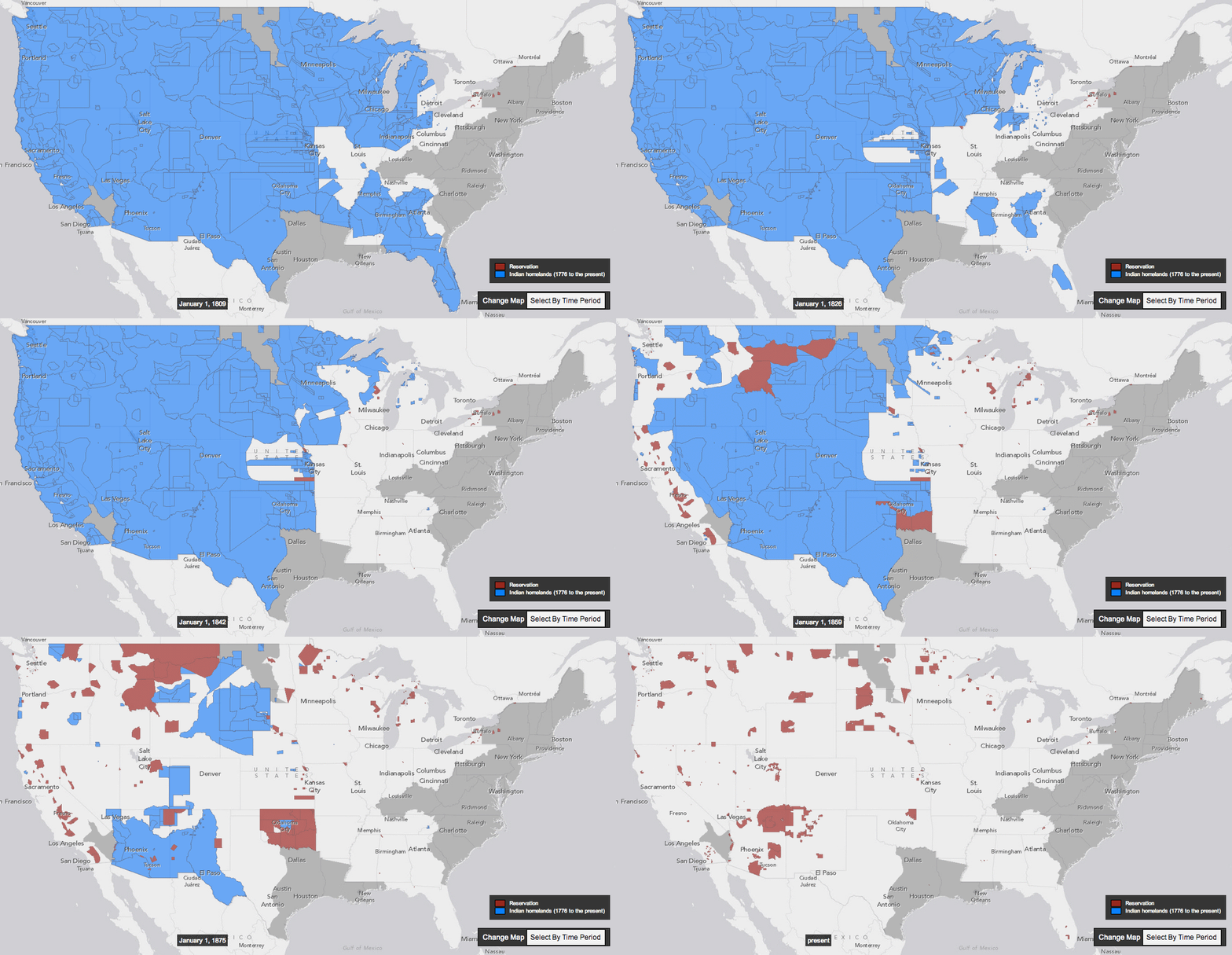
University of Georgia historian Claudio Saunt is looking to correct that, at least in the case of Europeans' violent seizing of Native Americans' land. To supplement his new book, West of the Revolution: An Uncommon History of 1776, Saunt created an interactive map showing the decline of Indian homelands from 1776 to 1887. Along with Slate's Rebecca Onion, he turned that map into a GIF, showing just how rapidly European-Americans took what amounted to over 1.5 billion acres:

Source: Rebecca Onion and Claudio Saunt
Blue areas were American Indian homelands, red ones reservations. To be clear, a lot of these boundaries are rough, and many treaties negotiated with tribes used vague area markers, which both makes mapping difficult and made it easier for the US government to increase its land gains. Even so, the rapidity of the transformation is astounding.
 RSS Feed
 Twitter
 7:07 AM
 art&beauty